Palestinian Authority
1988 - 2017
Previously referred to as the "West Bank" - and now by some as "Palestine"

Bethlehem
Bethlehem 2017 - Qalqiliyah 2009 - Monastery of the Temptation 2006 - Anti-terrorist Fence 2006 - Jordan Valley 2006 - Qumran Caves 2006 - Bethlehem 1988

Note of the use of putative country name Palestine

St Catherine's church
St Catherine's church
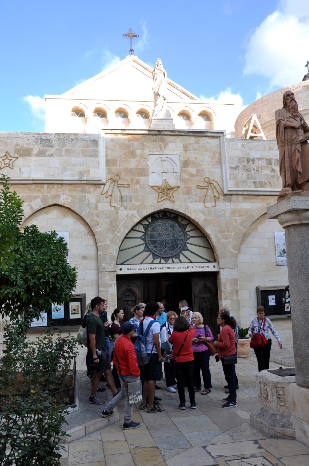
St Catherine's church

Church of the Nativity
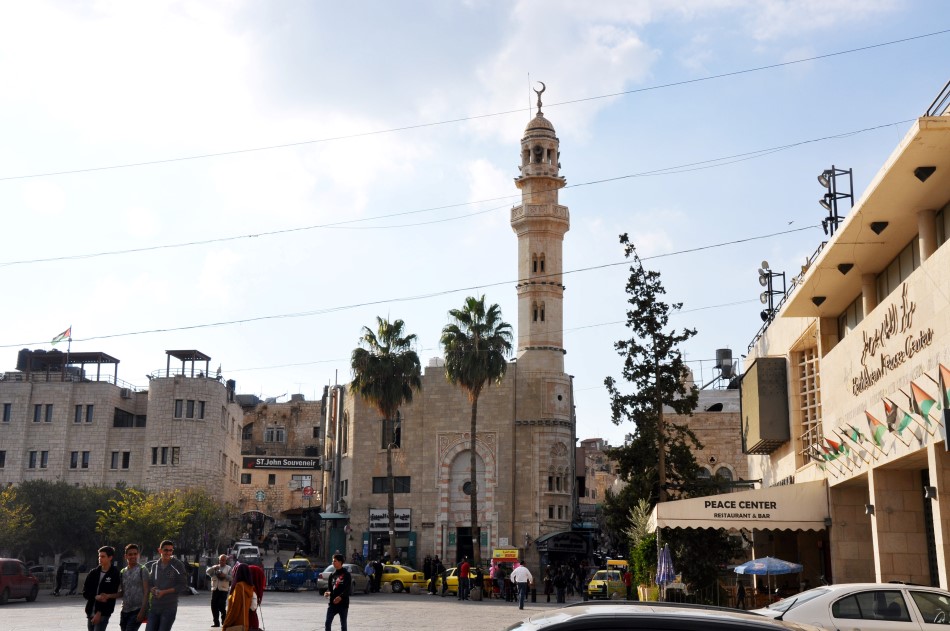
Mosque on Manger Square

Church of the Nativity

Church of the Nativity

Church of the Nativity

Church of the Nativity

Old inscriptions discovered during refurbishing

Mosaic floors

Mosaic floors

State of Palestine - Electronic gateway for government services

Palestine license plate - the Arabic letter is an F, for Filistin (Palestine)

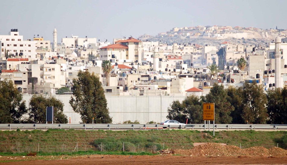
The Israeli anti-terrorist barrier - note the tower. The sign points to a car parking area.

The Israeli anti-terrorist barrier

The Israeli anti-terrorist barrier - covered with anti-Israel graffiti

The Israeli anti-terrorist barrier - covered with anti-Israel graffiti - note the rockand bomb throwers

The Israeli anti-terrorist barrier - covered with anti-Israel graffiti
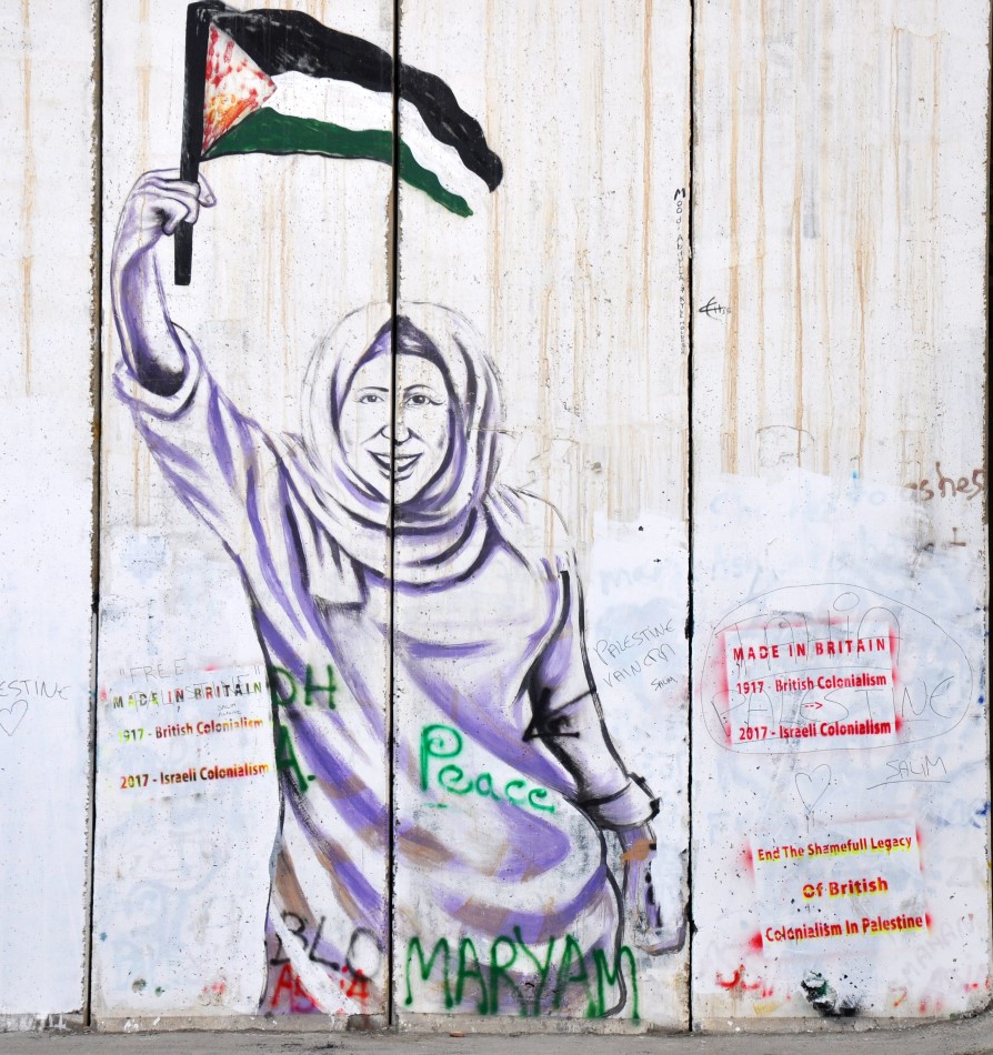
Image of Leila Khaled, a member of the Popular Front for the Liberation of Palestine who is notorious for her role in
a 1969 hijacking
and one of four simultaneous hijackings the following year as part of Black September.


Distant view of Jerusalem over the wall from the West Bank


Palestinian Police - Police center of the city of Bayt Laham (Bethlehem)

Shawarma - note the use of the new electric meat shaver - sort of takes the charm out of the whole process

Falafel

Google Earth image of security wall shown in photograph below between Qalqiliyah and Israel
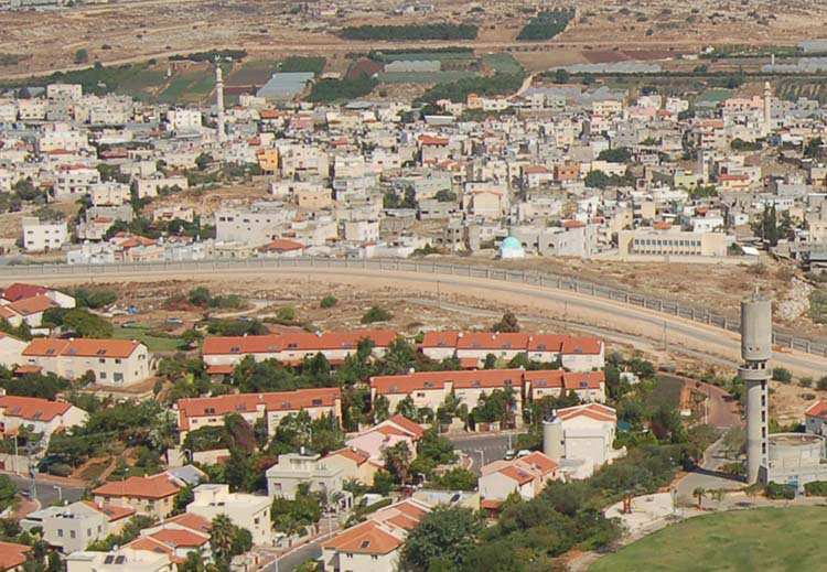
Note that the town is completely sealed from Israel - residents from both sides used to move back and forth - no more
Security wall between Qalqiliyah (top) and Israel at Israel's narrowest point (7.5 miles)

Security wall between Qalqiliyah and Israel at Israel's narrowest point (7.5 miles)

Security wall between Qalqiliyah and Israel at Israel's narrowest point (7.5 miles)

Google Earth image of Israeli military position and gate in photographs below
Check the fence and gate at Google Earth 32 11 35.36N/34 59 57.52E

Israeli military position

Gate from inside the Palestinian area

Gate from inside the Palestinian area
Israeli military post, gate and road from the Palestinian side

Israeli patrol

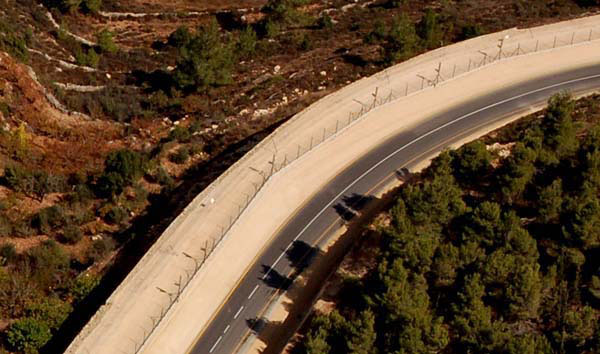
June 4, 1967 border road between Israel (right) and then-Jordan

June 4, 1967 border road between Israel (right) and then-Jordan

Section of the security fence

Palestinian police post

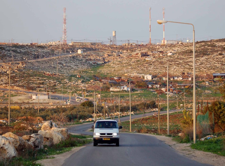
Palestinian town on West Bank

Life on the West Bank

Men playing "tawlah"


Eurasian jay - sitting on fence that marks the June 4, 1967 border between Israel and then-Jordan (now the West Bank)

Lt Col (res) Danny Grossman, Rick and Maj Gen (res) Uzi Dayan
- Danny flew F-4's in both the USAF and IAF
- Uzi is the former commander of Central Command and proponent of the security barrier
Monastery of the Temptation
2006


The Monastery of the Temptation (Dayr al-Quruntal) is an Orthodox monastery located in the West Bank along a cliff overlooking the city of Jericho and the Jordan Valley. It is built on the slopes of the Mount of Temptation, rising 350 meters above sea level. The earliest monastery was constructed by the Byzantines in the 6th century above the cave traditionally said to be that where Jesus spent forty days and forty nights fasting and meditating during the temptation of Satan.


IDF Major Kaufmann briefing on the fence
Helicopter tour route - from Netanya to the Golan Heights

Barrier along the main north-south highway near Raanana-Qalqiliyah

Barrier between Palestinian city (above) and Israel

Wall and tower - Palestinian area to the left

Tower inside Israel
Palestinian town above, Israel (they favor red roofs) below - note tower

Tower in Israel - irrigation available, thus greenery


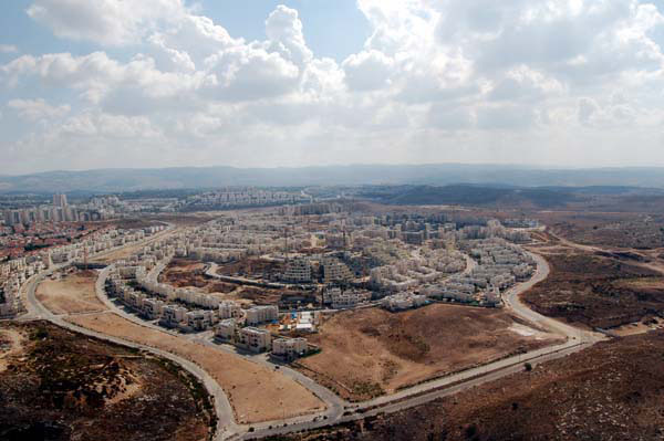
Israeli settlement completely protected by the barrier

Generally, the side with trees and greenery is in Israel
Flying in the Jordan Valley at an altitude of 275 feet below sea level

The border with Jordan

The border with Jordan

The border with Jordan

The border with Jordan

The border with Jordan

The Jordan River

Crocodiles

Bedu on his horse

Bedu camp

Ruins used by Israeli military

Israeli communications intercept facility

Jordan across the Dead Sea


Qumran Caves are a series of caves, some natural, some artificial, found around the archaeological site of Qumranin the Judean desert on the West Bank. It is in a number of these caves that the Dead Sea Scrolls were discovered.

Church of the Nativity
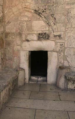
Humility Door of the Church of the Nativity
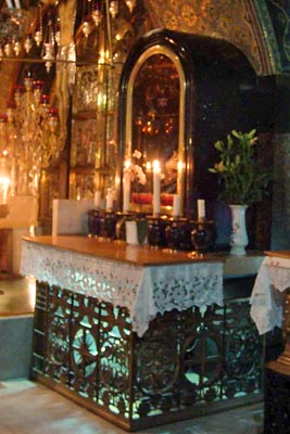
Altar in the Church of the Nativity
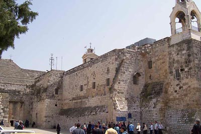
Church of the Nativity

Altar in the Church of the Nativity

Mosque on Manger Square

Spot marking the spot of the birth of Jesus in the Church of the Nativity